Walk amongst the majesty of Kā Tiritiri o te Moana / The Southern Alps
Halfway along the Milford road is the starting point (or end point) of one of New Zealand’s most famous Great Walks. The Routeburn Track is a spectacular alpine walk that can be walked in either direction from The Divide, off the Milford Road, or the Routeburn Shelter near Glenorchy. The track also connects with the Greenstone or Caples Track to make a circuit. The Routeburn Track also offers great options for day walks - guided or independent.
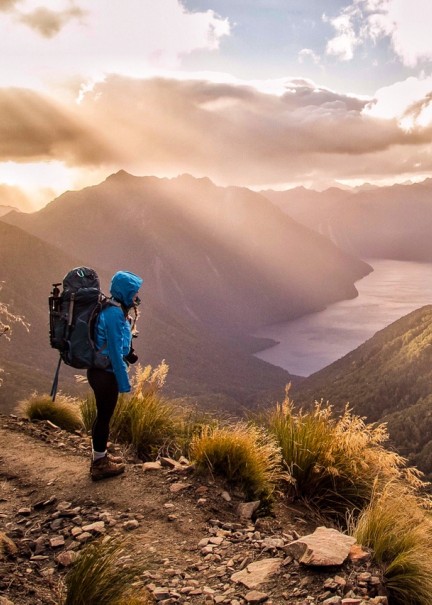
The full Routeburn Track is 31 km long (19 miles) and is a 3-day walk, offering hikers an ever-changing panorama of snow-capped peaks, sparkling alpine lakes, immense valleys, and the Routeburn River. Highlights of the Routeburn Track include views of Mt Tutuko, Fiordland’s highest peak and the view from the track’s highest point, Harris Saddle, at 1,255 metres (4,117 feet) above sea level.
The stunning kōtukutuku tree fuchsia is hard to miss along the Key Summit to Divide section of the track. Reaching heights of 12 metres, kōtukutuku is popular with local birds, such as tui, silvereyes, and bellbirds, and features an interesting orange-coloured paper bark.
The Routeburn Track can be undertaken as a guided walk or independently. Guided walkers stay in private huts while independent walkers stay in Department of Conservation (DOC) huts or tents. As the track is not a circuit, independent walkers will need to arrange a bus or transfer service once they have finished the walk.
While the Routeburn Track is revered as a Great Walk, it is also easy to tackle parts of the track as a day walk. A popular walk is the three-hour return Key Summit Track, which starts from the Divide car park. Many keen walkers include this hike as part of a Piopiotahi Milford Sound road trip.
HOW TO WALK THE ROUTEBURN TRACK
The Routeburn Track is a popular multi-day hike which is often undertaken by walkers of moderate ability. The track is well-marked, but due to some steep and high sections, it is prone to muddy and slippery areas. Poor weather conditions can make this walk challenging, even in the Great Walks season.
There are several ways to experience the Routeburn Track. It is possible to walk between The Divide and The Routeburn shelter, which takes 3 days and two nights. Another option is to walk into either the Routeburn Falls Hut or the Lake Mackenzie Hut to spend the night, then return the same way. It is also possible to spend two nights at one of the huts and take your time exploring the area.
The full track covers a distance of 36 kilometres (22 miles) and is usually done in three days and two nights.
Routeburn Track © Vaughan Brookefield
IMPORTANT ROUTEBURN TRACK INFORMATION
The track is open for independent walkers and guided walks during the Great Walks season (late October to late April), and walkers should always check the weather conditions.
The Routeburn Track must be pre-booked during the Great Walks season. You can book a bed in a hut or a tent site at one of the two campsites on the track (Routeburn Falls and Lake Mackenzie). During the winter months (May to October), the track remains open, but with reduced facilities and additional safety risks associated with avalanche danger in the alpine section to consider.
During the Great Walks season, huts offer bunks, mattresses, heating, toilets, basic cooking facilities, solar-powered lighting, cold running water, and a DOC ranger in residence. Campsites offer basic facilities including toilets, sinks and a water supply. Bookings are essential.
Fiordland's weather is highly changeable, and unprepared walkers may find themselves facing severe weather, snow-covered alpine passes, ice and slips on the track. Contact the Fiordland National Park Visitor Centre before you walk out of season, and always check weather conditions.
Check out the Department of Conservation Routeburn Track website here.